
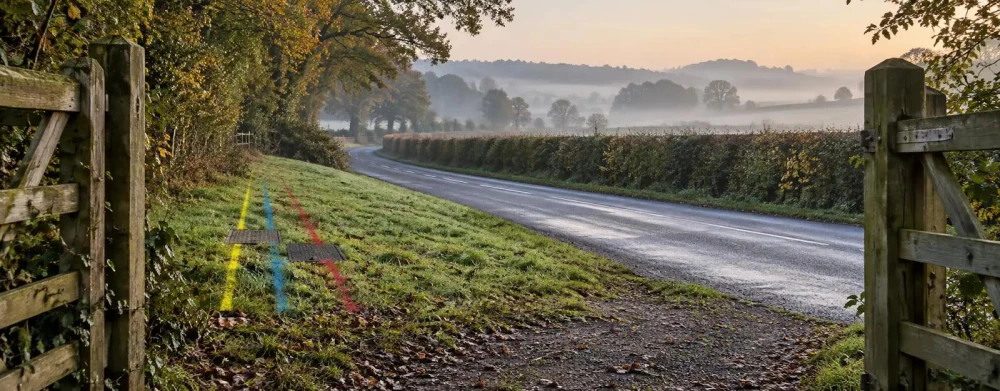
Utility Mapping Surveys in Surrey
Get in TouchAt Ranger Surveyors, we specialise in utility mapping surveys across Surrey and the surrounding KT15 1 postcode area. Our surveys are designed to accurately detect and map underground services such as gas lines, water pipes, and electrical cables.
We use advanced ground-penetrating radar (GPR) and electromagnetic detection methods to ensure precise results. Whether for construction planning or safety assessments, our service is tailored to meet your specific needs.
Contact us today to arrange your utility mapping survey.
What Is a Utility Mapping Survey?
A utility mapping survey identifies and maps utilities buried underground. At Ranger Surveyors, we provide detailed surveys to help you locate features like water mains, gas pipes, and electrical conduits.
Our surveys use state-of-the-art equipment including Ground Penetrating Radar (GPR) and electromagnetic locating devices, providing vital data for construction projects and infrastructure planning.
We adhere to the PAS 128 standard, which specifies the methodology for detection, verification, and location of underground utilities. Our team also uses GPS and geographic information systems (GIS) technology to integrate survey data with mapping software, improving accuracy and ease of use in projects.
Survey results typically include colour-coded utility maps and reports indicating utility types and depths, essential for engineers and architects to design safely and efficiently. Knowing the exact location of these utilities reduces the risk of damage during excavation and ensures the safety of workers on site.
For enquiries or to schedule a survey, contact us today.
Book Utility Mapping Surveys Today
How Much Does a Utility Mapping Survey Cost in Surrey?
Utility mapping surveys typically cost between £200 and £500 per location in Surrey. The price depends on the size and complexity of the area being surveyed, as well as the level of detail required.
Factors such as underground congestion, the variety of utilities (e.g., gas, water, electricity, telecommunications), and the depth of required mapping can influence the cost. For instance, employing electromagnetic detection and ground-penetrating radar often necessitates additional investment, especially in densely populated or industrial zones where utilities are layered.
Larger sites or those with extensive utility networks may incur higher costs, particularly when compliance with PAS 128 standards is demanded. Our team at Ranger Surveyors will provide a detailed quote based on your specific needs.
We ensure that all necessary equipment and data collection methods are considered for an accurate survey. Get in touch today for a personalised estimate.
Speak to a Utility Mapping Surveys Expert
Why Choose Ranger Surveyors for Utility Mapping Surveys in Surrey?
Choosing Ranger Surveyors for your utility mapping means trusting a team with extensive experience and expertise. We employ the latest technologies such as GPR (Ground Penetrating Radar) and electromagnetic induction to offer comprehensive mapping of utilities, ensuring all underground utilities are accurately detected and recorded.
Our team adheres to PAS 128 standards, which guide the quality and accuracy requirements of public utility surveys in the UK.
We use advanced equipment like multi-frequency GPR systems that allow for detection at different depths, and EM locators that can differentiate between live and non-live cables. Projects are typically completed within two to three weeks, depending on complexity and size, allowing you to plan with confidence.
Our focus on precision and reliability makes us a preferred choice in Surrey. We also commit to delivering accurate surveys on time, helping you meet your project deadlines efficiently.
Request a survey today to see the difference we can make.
Frequently Asked Questions
How long does a utility mapping survey take?
Most utility mapping surveys in Surrey are completed within one to two days. Specific timelines can vary depending on site size and complexity.
What equipment is used in utility mapping?
We use ground-penetrating radar (GPR) and electromagnetic locators to detect and map utilities accurately across Surrey.
Is utility mapping necessary for small projects?
Yes, even small projects can benefit from utility mapping to prevent accidental damage to underground services during excavation.
Can surveys detect non-metallic pipes?
Yes, our equipment can detect both metallic and some non-metallic utilities, providing an underground map.
How is the data presented after the survey?
We provide detailed digital reports and maps, making it straightforward for project managers to interpret the results and plan accordingly.
Get a Free Quote for Utility Mapping Surveys in Surrey
Contact Ranger Surveyors today for a professional utility mapping survey in Surrey. Our reliable team is ready to provide the detailed data you need for your project.
We cover Surrey