
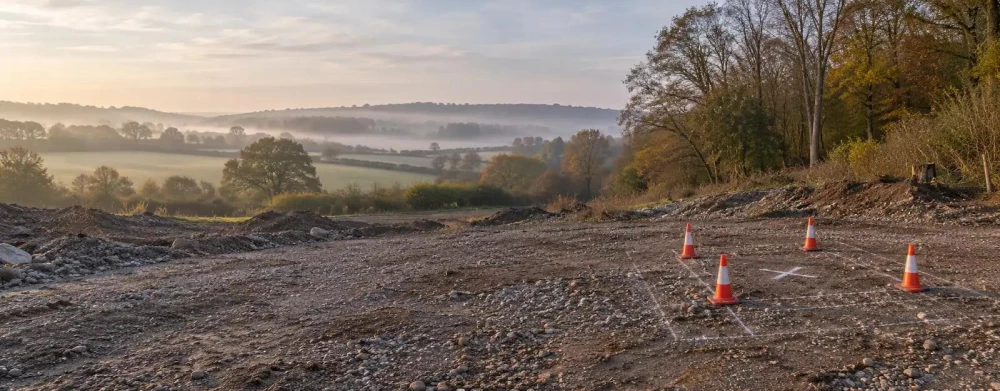
Borehole Utility Clearance Surveys in Dorking
Get in TouchAt Ranger Surveyors, we provide borehole utility clearance surveys throughout Dorking and the surrounding RH4 1 area. Our service helps identify the location of underground utilities, preventing potential hazards during drilling operations.
We use advanced technology including electromagnetic detection and ground-penetrating radar (GPR) to precisely locate utilities like gas lines, water pipes, and electrical cables. Our surveys protect your site from damage and ensure compliance with safety standards, helping your project proceed without costly delays.
What Is a Borehole Utility Clearance Survey?
A borehole utility clearance survey is an assessment we perform to locate underground utilities before borehole drilling begins. At Ranger Surveyors, we use techniques like ground-penetrating radar and electromagnetic detection to map out buried utilities safely.
Ground-penetrating radar can penetrate various soil types to a depth of several metres and is ideal for identifying non-metallic utilities, while electromagnetic detection is effective in locating metallic pipes and cables. We also adhere to British Standards BS 5930 and PAS 128, which ensure the accuracy and reliability of our surveys.
By identifying the exact positions of cables, pipes, and other services, we prevent inadvertent damage and accidents on your site. These surveys are crucial in high-density areas of Dorking where multiple utilities may intersect.
Our clients include construction companies, property developers, and government agencies keen to mitigate risk and maintain project timelines.
How Much Does a Borehole Utility Clearance Survey Cost in Dorking?
Borehole utility clearance surveys typically cost between £500 and £1,500 in Dorking. The exact price depends on factors such as the size of the site, complexity of the underground network, and the survey methods required.
We offer a range of technologies like Ground Penetrating Radar (GPR) and Electromagnetic Location (EML) to detect utilities such as water, gas, electricity, and telecommunications lines. Larger sites may need multiple survey days, while more intricate networks might require advanced imaging techniques for accurate results.
Compliance with PAS 128 standards ensures we deliver precise data to guide your drilling activities. Clients ranging from property developers to infrastructure managers often rely on our surveys to prevent costly utility strikes and complications in construction projects.
Contact us to discuss your site specifics and get an accurate quotation tailored to your needs.
Book Borehole Utility Clearance Surveys Today
Why Choose Ranger Surveyors for Borehole Utility Clearance Surveys in Dorking?
At Ranger Surveyors, we specialise in delivering reliable borehole utility clearance surveys in Dorking. Our experienced team uses advanced equipment, including ground-penetrating radar (GPR) and electromagnetic locators, to ensure accurate detection of underground utilities.
We follow industry standards such as PAS 128, which governs underground utility detection, to provide dependable and thorough results.
Our surveys are suitable for a range of clients, including construction companies, utility providers, and large infrastructure projects, who need to ensure safe drilling and prevent costly utility strikes. We provide detailed reports that include schematic representations and depth information, aiding our clients in effective risk assessment and project planning.
Our methodologies help in minimising unexpected delays and reducing potential safety hazards.
Choose us for our attention to detail and commitment to client satisfaction. Contact us today for a detailed consultation.
What Types of Borehole Utility Clearance Methods Are Available in Dorking?
In Dorking, we offer a range of borehole utility clearance methods to suit various project needs. These methods are essential for safely conducting site investigations, infrastructure development, and environmental studies by accurately identifying and avoiding underground utilities.
Ground-Penetrating Radar (GPR): An effective method for locating buried services in various soil types, GPR uses radar pulses to create subsurface images. This technique is particularly suited for non-metallic pipes and cables, often detecting utilities as deep as 6 metres.
Electromagnetic Detection: Ideal for identifying metallic utilities underground, this method measures electromagnetic fields generated by metallic objects. It is highly effective for mapping existing cable networks and pipelines with precision.
Magnetometry: Used particularly for detecting ferrous metal objects, magnetometry identifies variations in the Earth's magnetic field caused by metal objects. This is often used in archaeological surveys or sites with historical significance.
We select each method based on site conditions and specific requirements, ensuring the most effective outcome for your project. Contact us to discuss the most suitable approach for your clearance needs.
How Does a Borehole Utility Clearance Survey Work?
Our borehole utility clearance survey process involves the following steps:
Initial Consultation: We discuss your project's requirements and specific site details, considering factors like soil composition and existing infrastructure.
Site Assessment: Our team conducts a preliminary survey to understand physical site conditions and plan a suitable utility detection strategy. This may involve examining historical site data and as-built drawings.
Utility Mapping: We use Ground Penetrating Radar (GPR) and electromagnetic techniques to locate and map utilities with precision. GPR can identify non-metallic objects, while electromagnetic tools detect metal pipes and cables.
Data Analysis: Our specialists analyse the collected data to confirm utility locations and integrate this into digital mapping tools like GIS for easy interpretation.
Reporting: We provide a report detailing utility positions, potential risks, and recommendations for safe drilling. Reports adhere to PAS 128 standards, ensuring reliable information.
This methodical approach helps to safeguard your drilling activities and maintain compliance with health and safety regulations, reducing the risk of damaging utilities and avoiding costly project delays. Contact us to learn more about how we can support your project needs.
Speak to a Borehole Utility Clearance Surveys Expert
How Long Does a Borehole Utility Clearance Survey Take?
A typical borehole utility clearance survey in Dorking takes between one to three days, depending on site complexity and size. We use specialised equipment such as ground-penetrating radar (GPR) and electromagnetic locators to detect utilities.
This technology helps us produce precise maps by recognising various utilities at different depths. For sites with high-density utility networks or those located in urban areas, the survey may extend to four or five days to ensure no utility is overlooked.
Our experienced surveyors adhere to BS 5930 standards, ensuring that our assessments are both accurate and comprehensive, reducing the risk of project delays. Large or particularly complicated sites may require additional time for thorough assessment and accurate mapping.
Ensure your project stays on track by scheduling your survey well in advance.
What Are the Benefits of Borehole Utility Clearance Surveys in Dorking?
Borehole utility clearance surveys offer numerous benefits for projects in Dorking, ensuring a smoother and more secure development process. These surveys use geophysical methods such as ground-penetrating radar and electromagnetic locating to accurately identify underground utilities like water pipes, electrical cables, and gas lines.
Safety Assurance: Prevent accidents by avoiding utility strikes, which can lead to hazardous leaks or electrical issues.
Cost Efficiency: Save costs by minimising damage to underground services, which reduces repair expenses and downtime.
Regulatory Compliance: Ensure adherence to local safety standards such as PAS 128, which governs the identification and verification of underground utilities.
Timely Completion: Avoid delays caused by unforeseen utility interactions, facilitating projects to stay on schedule and within budget.
We are experienced in working with a variety of client types, including construction companies, developers, and municipal bodies. Consult with us to understand how these surveys can benefit your specific project needs.
Frequently Asked Questions
What is the lead time for arranging a survey?
The lead time is typically one to two weeks. We recommend booking as early as possible to avoid delays.
Are your surveys compliant with national standards?
Yes, our surveys comply with applicable UK standards to ensure safety and reliability.
Can you provide surveys for large industrial projects?
Yes, we cater to both small and large-scale projects, providing solutions for each.
What equipment is used in the surveys?
We use ground-penetrating radar, electromagnetic detectors, and magnetometers to accurately map underground utilities.
Do you cover areas outside of RH4 1?
Yes, we also service surrounding regions beyond the RH4 1 area. Contact us to confirm your location coverage.
Get a Free Quote for Borehole Utility Clearance Surveys in Dorking
Ready to secure your site with a borehole utility clearance survey? Contact Ranger Surveyors today and ensure your project proceeds safely and efficiently.
We cover Dorking (Surrey)