
Laser Scanning Surveys in Northallerton
Get in TouchAt Ranger Surveyors, we offer comprehensive laser scanning surveys in Northallerton, providing an accurate means of capturing detailed 3D representations of buildings and other structures. Our techniques enable us to measure complex geometries and inaccessible areas efficiently.
Serving both commercial and residential clients, we ensure precise data is collected to facilitate projects across the DL7 8 postcode area. Contact us to discuss how Ranger Surveyors can assist your next project.
Book Laser Scanning Surveys Today
What Is a Laser Scanning Survey?
A laser scanning survey is a method of accurately capturing the 3D geometry of structures and environments. At Ranger Surveyors, we use this technique in Northallerton to create detailed digital models with high precision.
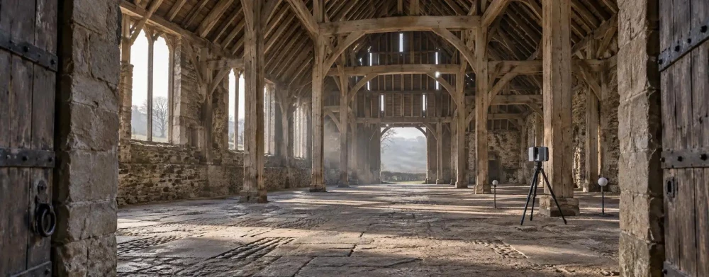
Our process involves using laser beams to measure the distance between the scanner and object surfaces, generating comprehensive point cloud data. We employ equipment like FARO Focus and Leica ScanStation, known for their accuracy and efficiency in capturing minute details.
This data not only aids in visualisation but also facilitates tasks such as Building Information Modelling (BIM) and structural analysis. Laser scanning surveys are particularly useful for heritage conservation projects, where preserving intricate architectural features is crucial.
The obtained data supports efficient planning and design modifications, making it invaluable for architects, engineers, and construction professionals needing precise project data.
How Much Does a Laser Scanning Survey Cost in Northallerton?
A laser scanning survey typically costs between £1,500 and £3,000 per day in Northallerton. The cost varies depending on factors such as site size, complexity, and project duration.
Smaller projects or straightforward surveys may require fewer resources and time, while larger or more intricate sites with multiple elevations and detailed measurements will take longer to complete. Equipment like Leica or Trimble laser scanners are often used for their precision and efficiency.
Additionally, compliance with industry standards such as the RICS guidelines for measured surveys ensures we meet regulatory requirements. At Ranger Surveyors, we ensure competitive pricing while delivering accurate survey results that can assist architects, engineers, and construction managers with project planning and execution.
Request a tailored quote to see how we can meet your needs within your budget.
Why Choose Ranger Surveyors for Laser Scanning Surveys in Northallerton?
Choosing Ranger Surveyors for laser scanning surveys in Northallerton ensures accurate, reliable, and efficient service. We deploy the latest 3D laser scanners, including Leica and Trimble models, which register precise data even in challenging conditions.
Our team of skilled surveyors has extensive experience with diverse projects, from historical building preservation to large-scale construction developments.
We adhere to the highest standards in the industry, following the guidelines set by RICS (Royal Institution of Chartered Surveyors) to ensure the integrity and accuracy of our measurements. Our post-processing involves using specialised software such as AutoCAD and Revit to create detailed 3D models and point clouds, delivering data in formats suitable for BIM (Building Information Modelling) integration.
We are committed to helping you achieve precise project goals and offer detailed consultations for all our clients. Contact us today to schedule your survey.
Speak to a Laser Scanning Surveys Expert
What Are the Benefits of Laser Scanning Surveys in Northallerton?
There are several benefits to using laser scanning surveys in Northallerton. This method employs advanced LiDAR technology and high-resolution scanners, allowing us to produce precise three-dimensional models of buildings and landscapes.
Precision: Capture accurate and comprehensive data for complex structures. With accuracy levels typically within millimetres, laser scanning surveys facilitate detailed analysis and informed decision-making.
Efficiency: Gather detailed information quickly with minimal disruption. Scans can be carried out within a day, considerably reducing the time on-site compared to traditional methods.
Versatility: Suitable for various applications, including architecture, construction, and heritage conservation. Laser scanning supports BIM integration and forensic engineering, adapting easily to a wide range of project requirements.
Safety: Non-invasive method suitable for sensitive and inaccessible areas. This method eliminates the need for potentially hazardous manual measurements, ensuring safety standards are maintained.
These benefits make laser scanning an invaluable tool for a range of projects, aiding architects, contractors, and conservationists in planning and execution. If you require precise and efficient surveying, consider leveraging our laser scanning services.
Frequently Asked Questions
How long does a laser scanning survey take?
Most laser scanning surveys in Northallerton take one to three days, depending on site size and complexity. We tailor our approach to fit your project's specific needs.
What types of buildings can be scanned?
We scan all types of buildings and structures, from commercial offices to heritage sites. Ranger Surveyors uses adaptable techniques to suit each unique project.
Is laser scanning suitable for complex structures?
Yes, laser scanning is ideal for capturing the intricate details of complex structures. Our equipment allows detailed measurements for accurate modelling and evaluation.
What area do you cover?
Ranger Surveyors covers Northallerton and the surrounding DL7 8 postcode area. We serve diverse locations and diverse project requirements.
How soon can a survey be organised?
We recommend contacting us as soon as possible to schedule your laser scanning survey. Our team works efficiently to accommodate your timeframe.
Get a Free Quote for Laser Scanning Surveys in Northallerton
Reach out to Ranger Surveyors today to arrange your laser scanning survey in Northallerton.
We cover Northallerton (North Yorkshire)